By Brendan Ross
We’re excited to share that the creek survey results are in! Back in October 2024, The Gap Sustainability Initiative, in collaboration with Save Our Waterways Now (SOWN), carried out a series of cutting-edge environmental DNA (eDNA) surveys in Enoggera and Fish Creeks around The Gap. And now we have our most detailed snapshot yet of the creatures living in our local creeks.
These surveys used water samples to detect microscopic traces of DNA left behind by organisms. Even if a species is hiding, nocturnal, or just passing through, its presence can still be recorded. It’s like forensic science for the environment—and the results reveal an ecosystem that’s dynamic, complex, and sometimes surprising.
This sensitive technology helps us see where life is thriving or struggling, and provides data that over time helps us to improve the future for iconic species like the platypus.
Seven Sites, One Story
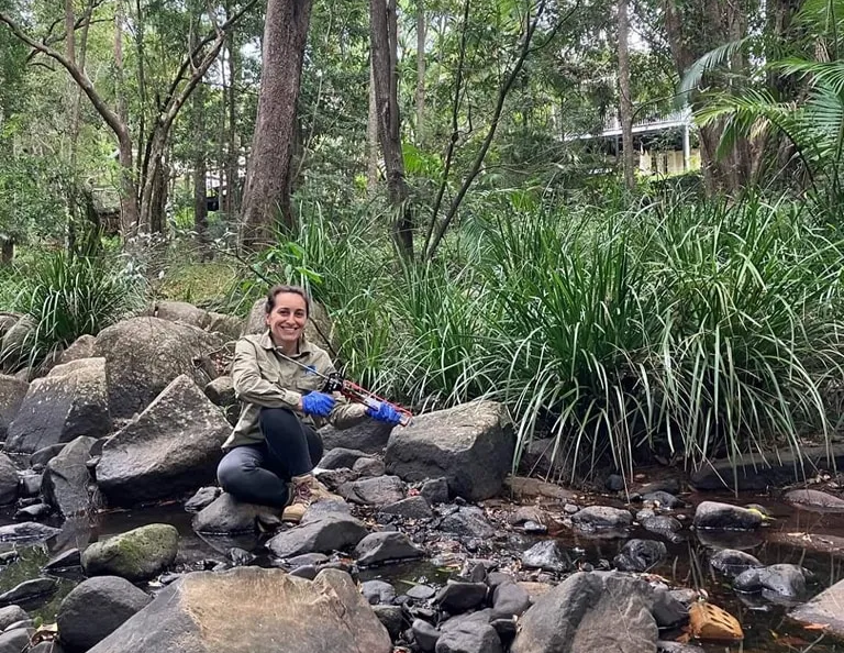
In October 2024, our volunteer scientists, Dr. Andrew Turley and Dr. Fanny de Busserolles, took three samples at each of seven sites across the Enoggera and Fish Creeks — from the most upstream point at Enoggera Reservoir to the most downstream site near Taylor Range. These samples were then sent to New Zealand for analysis by eDNA specialists, Wilderlabs.
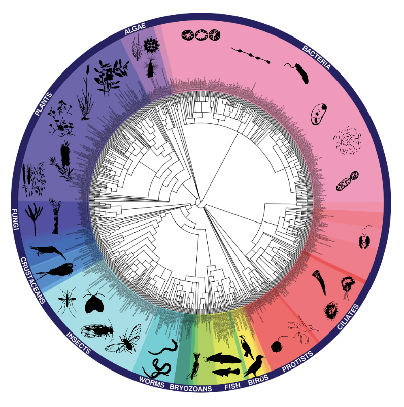
The “wheel of life” image below, based on the results, shows the incredible biodiversity found in our creeks. This snapshot reveals how the DNA traces clustered across broad categories: fish, insects, crustaceans, reptiles, plants, birds, mammals, and more. Avid citizen scientists can view and download more detailed data for each site. Just zoom in on the map to find The Gap sites and click on a batch to explore the results. The best way to interpret the date is in terms of the presence or absence of a species.

Wheel of Life: This graphic shows the diversity of life detected across all seven creek sites using environmental DNA. Each wedge represents a group of organisms—like fish, insects, crustaceans, and plants—found in the water samples. (Credit: Wilderlabs)
A Mix of Locals, Invasives and Absentees
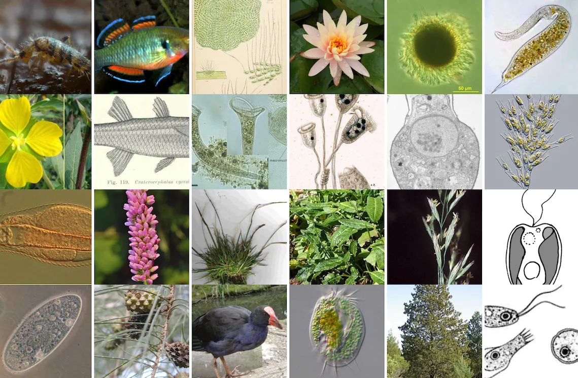
There’s good news here. Native fish such as the purple-spotted gudgeon, eel-tailed catfish, australian bass, and western carp gudgeon were found at various sites. There were also positive markers for the tusked frog at both sites in Fish Creek, and similarly the Stony Creek Frog at Walton Bridge. Our surveys also detected two species of turtles, two species of eel, and freshwater invertebrates like daphnia, freshwater shrimp, and freshwater prawn—essential building blocks of the aquatic food web.
However, the surveys also picked up numerous invasive species. For example, the Eastern mosquitofish appeared at multiple sites. The invasive cane toad also made a strong appearance. And the most commonly detected mammal? The dog. With a presence far exceeding any native mammal species, could it be having an impact more serious than previously recognised?
Some macroinvertebrates typically associated with healthy creek systems and beneficial to the platypus were also low or undetected in this round. These gaps could point to water quality or habitat limitations that may be restricting biodiversity in parts of the catchment, and warrant further consideration by our expert advisors.

Where did the Platypus Go?
At the heart of this work is a bigger question: Can we bring platypus back to our creek?
No platypus DNA was detected in this survey. However, historically platypus are known to have inhabited Enoggera and Fish Creeks. Long-term Gap residents share stories of seeing platypus in the 80’s and 90’s, such as under the School Road Bridge or in Fish Creek near St Peter Chanel School.
Have you ever seen a platypus in The Gap? Over the past 20 years, the Platyproject indicates only a few detections in our suburb. However, local platypus expert Dr. Tamielle Brunt was unable to confirm any of these recent reports through targeted eDNA analysis (see: Brunt et al., 2021). It’s possible that some of these visual sightings were actually of the Australian water-rat (rakali), which is often mistaken for a platypus due to similar features. Today, their presence seems to have all but vanished. It is likely a mix of habitat loss, pollution, predation, climate change, and other urban pressures.
This eDNA project gives us a baseline for what’s present now in the ecosystem, and clues about what needs to be done if we hope to see platypus return. Rewilding the platypus isn’t a simple task but it would be a powerful sign of a healthy creek and recognition of the patient, meaningful work that many in our community do to help restore and steward our beautiful waterways.
Join the Movement!
You can help us learn more! The Gap Sustainability Initiative and SOWN are running monthly community creek surveys that are family friendly. These surveys don’t use DNA technology—instead we get hands-on: collecting macroinvertebrates (ie. little creek critters), then sorting and recording what we see. It’s a fantastic way to learn something new (we’ll show you how), meet like-minded locals, and make observations that help us understand the creek’s changing conditions. Remember this is weather dependent and always check our Facebook Page for latest information.
See you there!
Location: Furmans Crossing Park, Yooralla Street The Gap
When: Monthly — every 3rd Sunday of the month 8.30 – 10.30am.
